
Explore the district
Interactive Map
uMkhanyakude spans four local municipalities linked by the N2 corridor, from the wetlands of Kosi Bay to the game reserves around Hluhluwe and the waters of Jozini.
District overview
Kosi Bay to Jozini
Four local municipalities, two international borders and a coastline, strung along the N2 and the R22. Below, five places that anchor the district’s investment corridor. A zoomable project map is being developed alongside the district GIS portal.
District locality plan
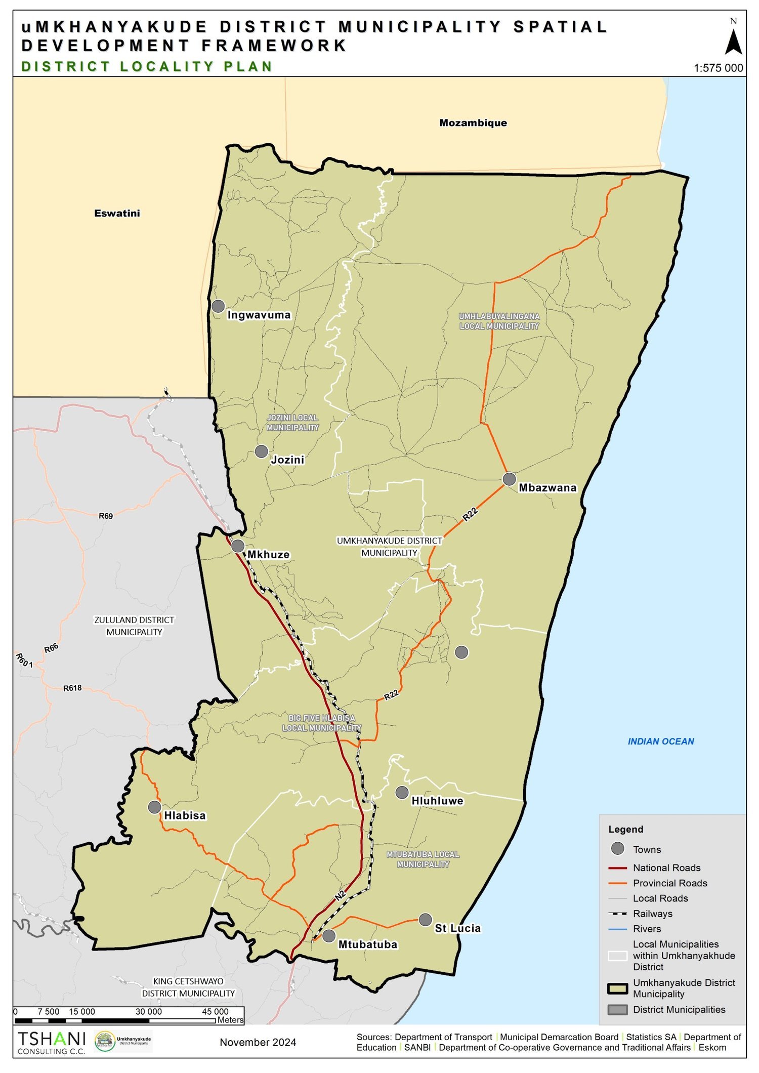
uMkhanyakude Spatial Development Framework — District Locality Plan, November 2024. Scale 1:575 000.

Kosi Bay
A lake and estuary system on the Mozambique border, part of the iSimangaliso Wetland Park.
Projects here

Mkuze
Gateway town to Mkhuze Game Reserve and the district's agricultural heartland.
Projects here

Jozini
Home to Jozini Dam — formed by the Pongolapoort Dam wall — a major water resource and lakeside tourism destination.
Projects here

Hluhluwe
Tourism and commercial node on the N2, bordering Hluhluwe–iMfolozi Park.
Projects here

Mtubatuba
The district's administrative and commercial hub, close to iSimangaliso and Sodwana Bay.
Projects here